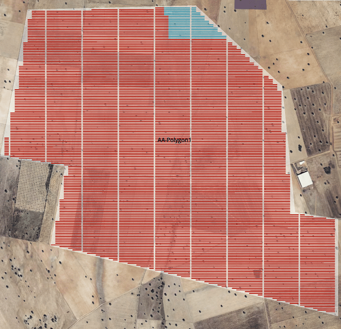
In RatedPower, the road layout is done automatically by the software. If your road layout preference includes vertical or horizontal roads, the distance between them is determined as follows:
1. Based on the DC/AC ratio and the number of inverters connected to one power station (PS) the software determines the number of structures per PS.
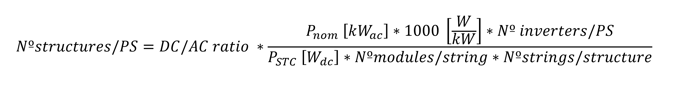
2. As shown in the next image, the software populates blocks (see the blue example) placing the amount of structures per PS calculated in the most square shape possible. A block consists of a PS and the structures that will connect to it.
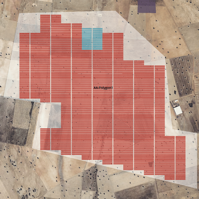
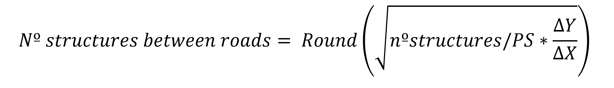
3. As we want each PS to be centred in its block, and the PS must be accessible through a road, the software considers roads should run through the middle of blocks. The distance between the roads can be calculated by defining the number of structures between the roads.
For vertical roads:
For horizontal roads:
 Where:
∆X is the horizontal dimension of the structure plus the horizontal clearance between structures.
∆Y is the vertical dimension of the structure plus the vertical clearance between structures.
Using trackers or east-west fixed structures, ∆X equals the pitch distance, and ∆Y equals the length of the structure plus the distance between structures.
Using fixed structures, ∆X equals the length of the structure plus the distance between structures, and ∆Y equals the pitch distance.
The layout example in this article uses the Regular Blocks option (Layout < Power Requirements < Type of Layout). If the design uses Adaptive Design, the road layout is maintained: