Google Earth terrain data are available by default to carry out topographical analysis. When greater precision in Spain is required, you can follow this article.
This article will show you how to import topography data from the IGN "National Geographic Institute" in RatedPower by using QGIS.
- Go to IGN website.
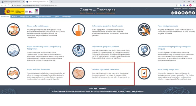
- Next, we need to access to "Download Centre".

- Click on "Digital Elevation Models", from where you will have information available throughout all Spanish national territory.
- Out of the 4 different models available, choose the one which fit you most, based on the spatial resolution required.
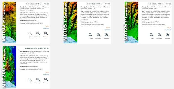
The spatial resolutions available are:
- MDT02: 2m x 2m spatial resolution.
- MDT05: 5m x 5m spatial resolution.
- MDT25: 25m x 25m spatial resolution.
- MDT200: 200m x 200m spatial resolution.
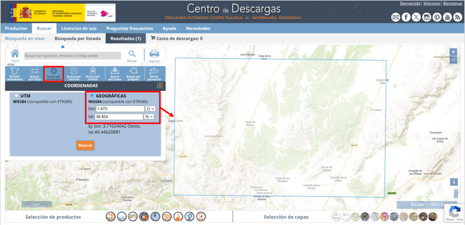
- Within the chosen digital model, search by coordinates and verify that the drawing includes your site location.
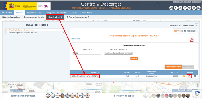
- In results, download the available TIF file with all the georeferenced topographic information.
- Finally, follow the instructions of this article to convert and import the data to RatedPower.
For further questions, please contact us at the following email address: support@ratedpower.com