This feature will allow you to transfer a selected parcel on PRISM into RatedPower. By doing so, you will have a smooth experience with seamlessly connected platforms.
Introduction
To site a solar project in PRISM, users can assess grid infrastructure, market conditions, and project economics to narrow down to an area of interest. From there, users can leverage the parcels dataset to evaluate key characteristics of the land and find the most suitable parcels for renewable energy development. With parcels in PRISM, users can compare geometries, ownership, acreage, and even land suitability to make well-informed project siting decisions.
What happens next? RatedPower can easily take over. It can read the information from PRISM and give the user a detailed PV plant design with the necessary documentation in a matter of minutes. The integration between the two softwares will save tremendous resources on your side, taking you from site definition to solar plant development.
Here is how to use the integration feature:
1. On the PRISM interface, select the desired parcel on the map. Then, from the Layer Inspect box, click the details button to open the Parcel Card. In the “Copy Parcel Link to RatedPower” subsection of the card, click "Copy to RatedPower".
.png?width=688&height=586&name=MicrosoftTeams-image%20(2).png)
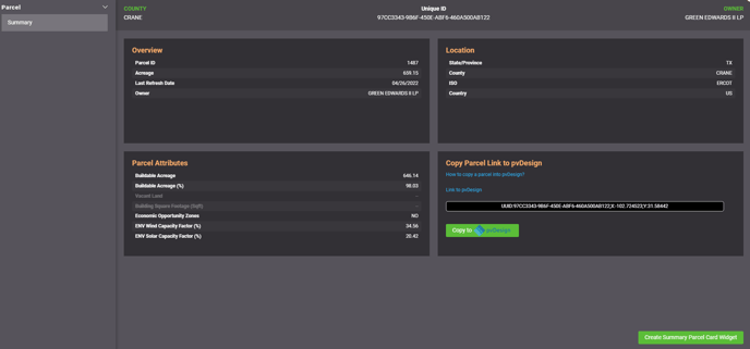
Another instance where you can access the parcel card is via the hyperlink in the Parcel ID section of the Data Table. From there, follow the same steps as above to copy the parcel to RatedPower.
.png?width=688&height=322&name=MicrosoftTeams-image%20(3).png)
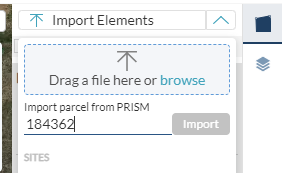
2. In RatedPower's site creator (Location tab > Site > New site > Create new site), click on "Site Elements" on the right bar, and select the drawdown list of "Import Elements". Paste the link copied to your clipboard into the text box below "Import parcel from PRISM" and click on "Import":
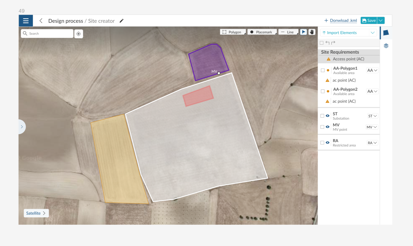
3. RatedPower will then load the parcel and its information on the map view. The new available area will appear as another polygon in the Site Requirements section. You can now go ahead and work on this site by setting the feature type (available area, restricted area, substation Area, MV line, etc.) of each element that has been imported:
Conclusion
This feature is the first step towards a seamless integration between PRISM and RatedPower. Our joint objective is to enable users to smoothly work on the two platforms, unifying resources to have all the information needed for various stages of solar plant development in one place.
For any other questions or more information regarding this topic, you can contact us at: support@ratedpower.com