Would you like to use French cadastral parcels in RatedPower? Then you're in the right place. This article will explain the process of acquiring parcels from the French site and incorporating them into your site creation within RatedPower!
If you already have your parcels in .shp format, you can now import them by following the steps described here: How to import site elements by uploading a file (KML, KMZ, SHP). If not, you can proceed with this article.
1. Download your parcel(s) from the French cadastral plan
- Go to https://cadastre.data.gouv.fr/.
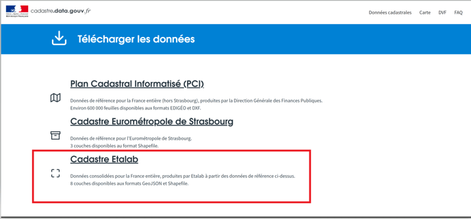
- Click on Télécharger les données.
- Choose the Cadastre Etalab.
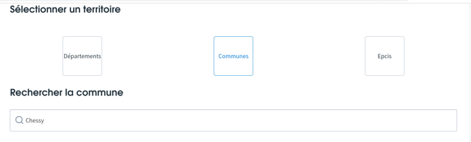
- You will be directed to the next page where you can scroll down to select the city in which your parcel is located by selecting Communes and entering the name of the city .
- Then, select the file format as GEOJSON/GZ and the type of layer as Parcelles.
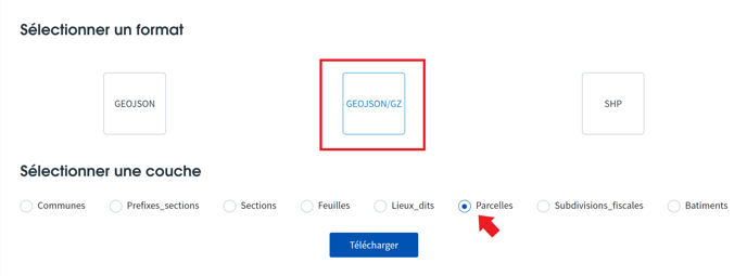
- After that, click on Télécharger to download the file.
2. Select your exact parcel(s) with QGIS
You will need the latest version of QGIS and the following plug-in:
- "QuickMapServices": In order to have the map view.
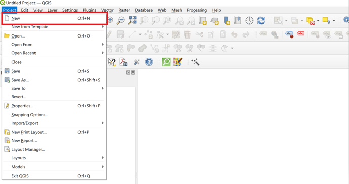
- Open QGIS.
- Create a new project by clicking on New.
- Add a vector layer by selecting Add Layer -> Add Vector Layer.
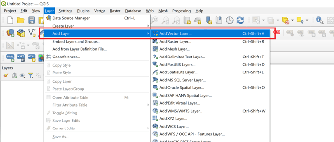
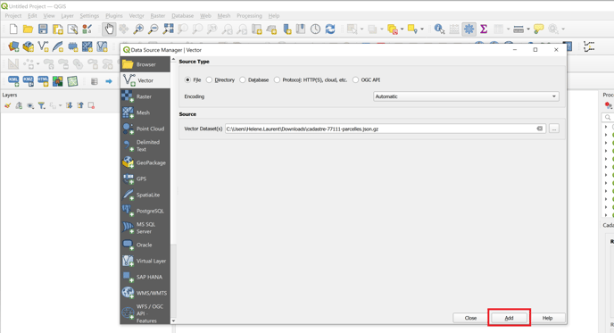
- Select the file that you downloaded previously and click on Add.
- You will now see the imported parcels on QGIS.
- We suggest that you add a satellite layer to identify the parcel(s) you need.
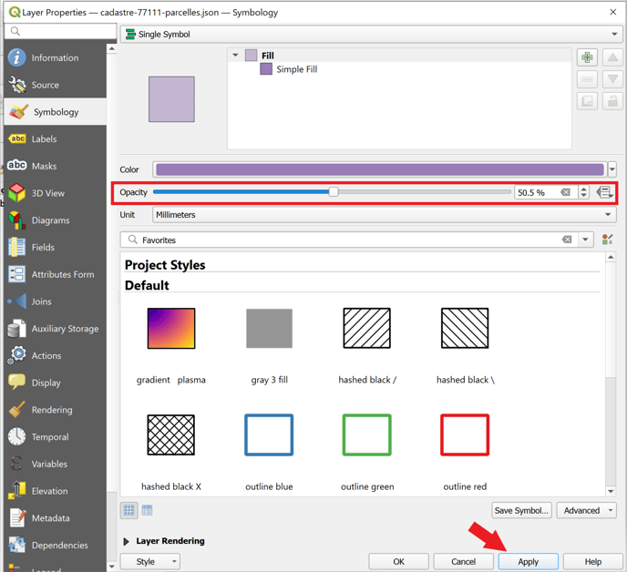
- Additionally, adjusting the opacity of the parcel layer, allows you to simultaneously observe both the parcels and the underlying map.
- To change the opacity: right-click on the layer and select Properties. In properties, reduce the opacity and click on Apply.
- You should now be able to see clearly the parcels on the map and select the ones you want to export with the Selection tool.
![]()
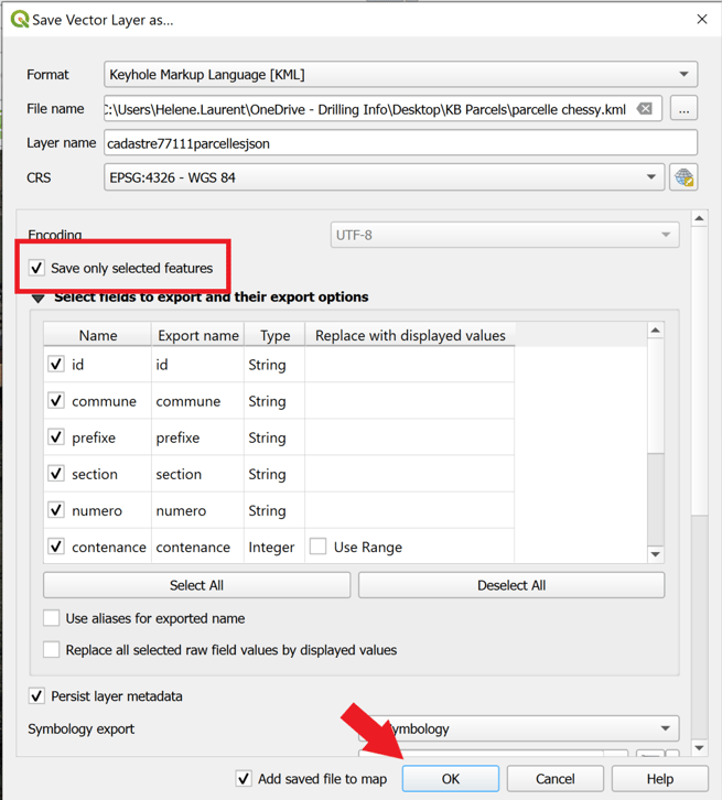
- Once the parcel is selected, right-click on the layer. Then click on Export -> Save Features As.
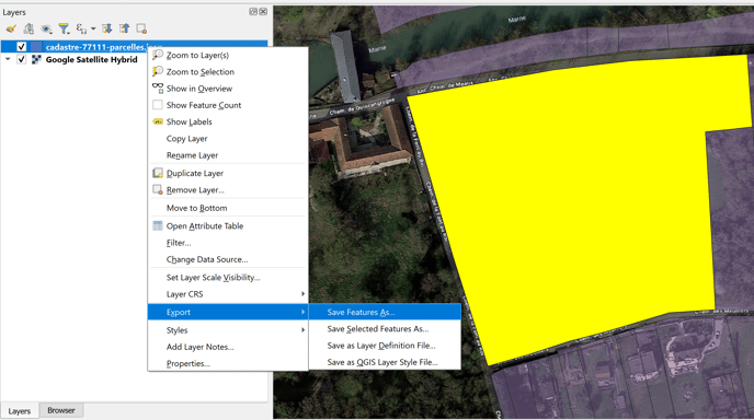
- Enter your file name and save the file in KML/KMZ format.
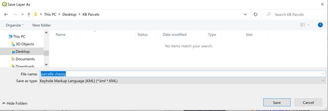
- Select Save only selected features and click on OK.
3. Import the parcel(s) in RatedPower
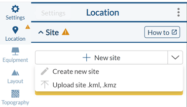
- Inside the design process you can import you parcels in the Location tab by clicking on New site -> Create a new site or upload site .Kml,.Kmz.
- Inside the Site creation tool you can also click on Import Elements and select the .KML, .KMZ file exported from QGIS.
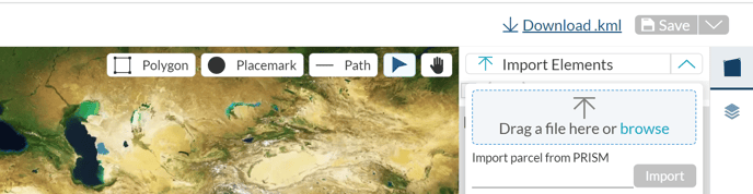
- Select Import Elements.
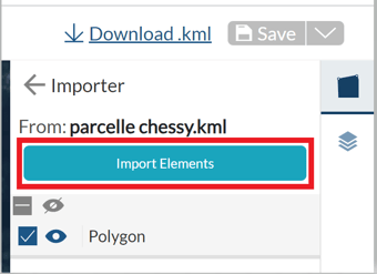
- Select and define the polygon as an Available area (AA).
Last step will be to define the other elements as usual, for more information on how to create a site take a look at this article.
For any other questions or more information regarding this topic, you can contact us at: support@ratedpower.com